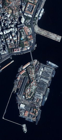
Data Acquisition | IKONOS was launched on September 24, 1999, and is owned and operated by Space Imaging, Inc. The data were first available January 1, 2000. Space Imaging, Inc. distributes IKONOS imagery under the product name CARTERRA. |
Timing | For areas of interest (AOI) less than 500 sq km, it takes 10 to 14 days to receive archived imagery; 60 days if the imagery must be collected. For all other image products, it can take up to 120 days. |
Cost | The prices of IKONOS imagery vary based on the accuracy of the product's georeferencing and any special data requests (i.e., different swath size, viewing angle, etc.). Price information can be found at the Space Imaging, Inc. Web site. |
Data Formats/Software Needed | Choice of untiled GeoTIFF or uncompressed NITF (National Imagery Transmission Format) 2.0. NITF format is available to approved government customers and supports 3-band 8-bit data, or 4 separate bands at 8-bit or 11-bit. Resellers also offer IKONOS imagery in a variety of formats. |
![[globe icon]](http://www.csc.noaa.gov/crs/rs_apps/sensors/images/E.gif) Projections | Supported Projections: Supported Datums: |
Licensing | All IKONOS imagery has user license agreements. The degree of licensing depends on the type of user and the intent for the data. The different licensing categories and costs can be obtained from Space Imaging, Inc. |
References:
- NOAA, Remote Sensing for Coastal Management.
