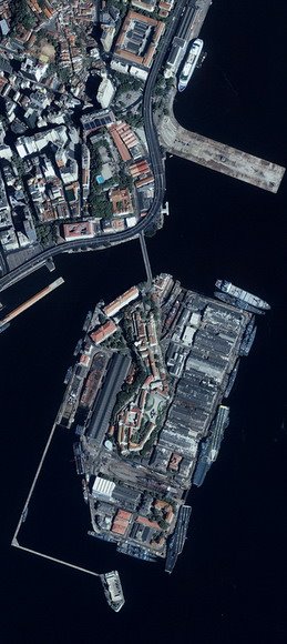
| Organization | GeoEye |
|---|---|
| Mission Type | Earth observation |
| Contractor | Lockheed Martin Space Systems |
| Satellite of | Earth |
| Launch | September 24, 1999 on an Athena 2 |
| Launch site | Vandenberg Air Force Base |
| Mission duration | 7 years |
| Mass | 726 kg (launch) |
| Semimajor Axis | 7056.97 km |
| Eccentricity | 0.00013 |
| Inclination | 98.10 degrees, sun synchronous |
| Orbital Period | 98.33 minutes |
| Right ascension of the ascending node | 68.015 degrees |
| Argument of perigee | 93.06 degrees |
| Speed on Orbit | 7.5 kilometers per second | ||||||||||||||||||||||||
| Speed Over the Ground | 6.8 kilometers per second | ||||||||||||||||||||||||
| Revolutions Around the Earth | 14.7, every 24 hours | ||||||||||||||||||||||||
| Altitude | 681 kilometers | ||||||||||||||||||||||||
| Resolution at Nadir | 0.82 m panchromatic; 3.2 m multispectral | ||||||||||||||||||||||||
| Resolution 26° Off-Nadir | 1.0 m panchromatic; 4.0 m multispectral | ||||||||||||||||||||||||
| Image Swath | 11.3 kilometers at nadir; 13.8 kilometers at 26° off-nadir | ||||||||||||||||||||||||
| Equator Crossing Time | Nominally 10:30 AM solar time | ||||||||||||||||||||||||
| Revisit Time | Approximately 3 days at 40° latitude | ||||||||||||||||||||||||
| Dynamic Range | 11-bits per pixel | ||||||||||||||||||||||||
| Image Bands | Panchromatic, blue, green, red, near IR |

Sensor Characteristic
| Sensor | Band | Spectral Range | Scene Size | Pixel Res |
| Multi-spectral | 1 = Blue | 455 - 520 nm | 11 x 11 km | 4 meter |
| 2 = Green | 510 - 600 nm | |||
| 3 = Red | 630 - 700 nm | |||
| 4 = NIR | 760 - 850 nm | |||
| Panchromatic | Pan | 450 - 900 nm | 1 meter |
References:
- Wikipedia, IKONOS.
- Satellite Imaging Corporation, Ikonos Satellite Images and Sensor Spesifications.

